
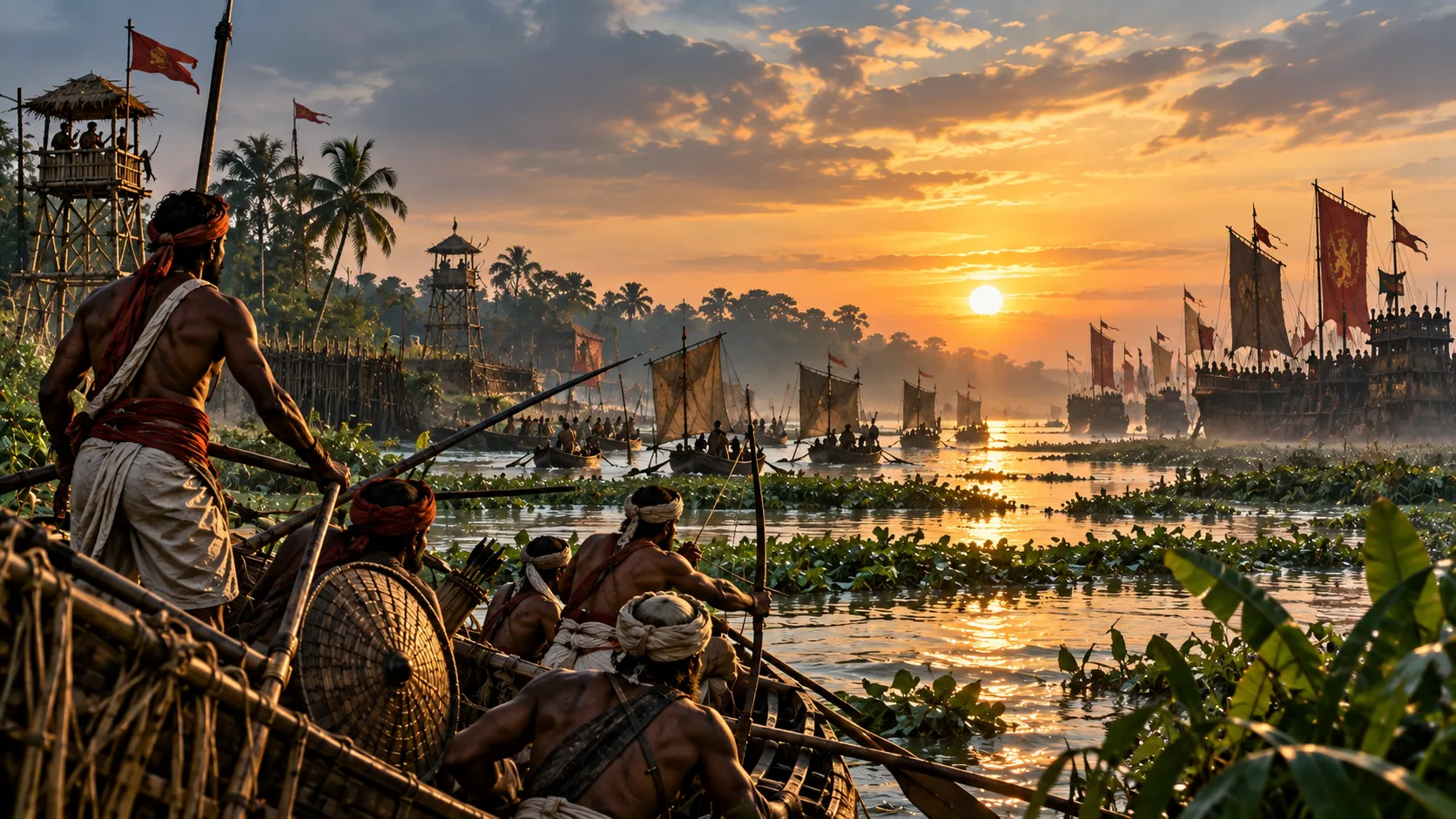
How Bengal Turned Its Rivers into Weapons
Bengal was not a country that could be understood from its roads alone. Its rivers were roads, boundaries, sources of food, commercial arteries and, in times of war, obstacles that could become advantages. Across the delta, land and water continually met, separated and changed places. For the people who lived within that environment, this was ordinary geography. For an army arriving from outside, it could become a strategic problem.
There are few places in South Asia where geography has shaped human life as profoundly as it has in Bengal. The region was formed by the great rivers descending from the north, by innumerable distributaries spreading across the delta, by wetlands and marshes, and, farther south, by tidal waterways opening toward the Bay of Bengal. Rivers carried people and goods, connected settlements and sustained agriculture, but they also determined where armies could move and how easily an outsider could operate.
For a civilization that had grown around this landscape, the waterways were familiar routes of movement. For an invading army, they could become an entirely different kind of problem. A river might not simply stand between an army and its objective. Its channels, banks, currents, mud and changing water levels could determine where that army was able to go, how quickly it could move and whether its conventional military advantages remained useful.
This is the beginning of a different way of looking at Bengal’s military history. The important question is not simply whether Bengal possessed ships or whether its rulers maintained naval forces. It is whether the people who lived in this extraordinary landscape learned to turn their knowledge of it into strategic power.
The evidence suggests that they did.
A Country Where Land and Water Overlap
The Bengal delta was not a landscape of clearly defined roads and permanent boundaries. Its waterways formed a complicated network of tributaries, distributaries and channels, while the lower delta was affected by tides and continual sediment movement. The changing character of these waterways meant that navigation depended not only on knowing where a river was, but also on understanding its channels, crossings, depths and seasonal behaviour.
This had obvious military consequences.
An army accustomed to open country could rely heavily on cavalry, large formations and predictable lines of movement. Such advantages became less straightforward in waterlogged terrain. Soft banks could hinder horses, while narrow or shallow waterways could restrict the movement of larger vessels. The research identifies precisely these conditions as important factors in the military environment of Bengal, particularly the disadvantages that muddy, waterlogged ground could create for cavalry and heavier forces.
The significance was not that Bengal’s environment automatically defeated every army that entered it. It did not. Rather, the landscape changed the conditions under which military power could be used.
A cavalry force was most effective where horses could move freely and formations could maintain their cohesion. A heavily equipped army depended on suitable ground for its equipment and animals. A large vessel similarly required sufficient depth and maneuvering space. In the delta, each of these assumptions could become uncertain.
The result was an environment in which familiarity mattered enormously.
The Real Advantage Was Knowing the Water
A river by itself is not a weapon.
Its military value comes from what people know about it.
A community that regularly travelled through a river system learned its channels, crossings and hazards in ways that an outsider could not acquire simply by arriving with a large army. In Bengal, where waterways could change and where the distinction between land and water was often less permanent than in other landscapes, this knowledge had particular value.
The research reconstructs a possible defensive system based around river reconnaissance, strategic control of confluences and narrow passages, and the use of lighter vessels capable of operating in difficult waterways. Such a system could also involve coordination between forces operating on land and those moving by water.
It is important, however, to distinguish reconstruction from direct evidence. We do not possess a surviving Bengal military manual that describes every riverine operation in detail. Some of the tactical system suggested by the research is therefore an interpretation of geography, literary evidence and later military practice rather than a completely documented operational doctrine.
That distinction does not make the underlying argument weak. It simply tells us how confidently we should state it.
The strongest conclusion is that knowledge of waterways could give Bengal’s defenders an advantage that an outside army could not easily reproduce.
When Strength Became Difficult to Use
The problem for an invading force was therefore not necessarily that Bengal possessed some mysterious military technology. It was that familiar military advantages could become less useful in unfamiliar terrain.
Consider the difference between fighting on an open plain and moving through a network of narrow waterways. On a plain, cavalry can exploit speed and maneuver, infantry can form large bodies, and commanders can observe the battlefield comparatively clearly. In a riverine environment, movement becomes constrained by channels and crossings. The ground beside the water may be soft, while the water itself may be too shallow or narrow for some vessels.
The research emphasizes this relationship between environmental conditions and military mobility. Soft banks and shallow waters could disadvantage cavalry and heavier forces while allowing lighter vessels and infantry greater freedom of movement.
This is why the military importance of Bengal’s geography should not be reduced to the statement that “there were many rivers.”
The crucial factor was the interaction between terrain, mobility and knowledge.
The same waterway that was an obstacle to one force could be a route for another. The same mud that slowed an unfamiliar army could be familiar ground to people accustomed to living beside it. And the same complex network that made Bengal difficult to navigate from outside could connect its own settlements and communities.
From River Landscape to Defensive Network
Once waterways became part of military planning, the river system could be treated not as a collection of obstacles but as a network through which an army itself could be detected, directed and restricted.
The research proposes a sequence beginning with reconnaissance of an approaching force, followed by control of strategically important confluences and narrow passages. River forces could then operate in coordination with positions on land, while smaller boats could potentially challenge larger or less maneuverable vessels.
The idea is important because it changes the nature of the defensive problem.
A defender does not necessarily have to destroy an invading army in a single battle. If the invader cannot move easily, cannot secure its supply routes, cannot cross waterways safely and cannot predict where resistance will appear, the cost of continuing the campaign increases.
The research describes this broader possibility as denial through attrition: rather than relying entirely upon one decisive confrontation, a defender could make sustained invasion increasingly difficult and expensive.
For Bengal, such an approach would have made particular sense because waterways were not peripheral to the civilization. They were part of its internal transportation network.
The defenders were operating inside their own environment.
The invader was trying to enter it.
The Gangaridai and the Eastern Frontier
The earliest major example discussed in the research is the Gangaridai.
Greek writers preserved a striking reputation of this eastern power. Diodorus Siculus described the Ganges as an enormous river and emphasized the extraordinary number of elephants associated with the Gangaridai. Other Greek accounts likewise preserved the impression that the Gangaridai and their eastern neighbours represented a formidable military obstacle to Alexander’s advance.
The traditional story is often reduced to the elephants.
That is understandable. Thousands of war elephants make an extraordinary image, and the Greek sources themselves emphasize them heavily.
But the geographical context matters too.
The Gangaridai were associated with the lower Ganges region, an environment of rivers, marshes and waterways fundamentally different from many of the open landscapes through which Alexander’s armies had previously fought. The research interprets this geography as a defensive advantage and suggests that river control, reconnaissance and the coordination of land and water forces could have added to the deterrent effect of the region’s military strength.
Here again, caution is necessary.
The surviving Greek accounts do not give us a detailed description of a Gangaridai naval battle or a complete river-defense system. The reconstruction of a coordinated riverine strategy is therefore an interpretation rather than an independently documented fact. The research itself uses cautious language when describing possible mechanisms by which the landscape could have been used defensively.
What we can say more securely is that the Gangaridai were remembered as a major military power in the eastern Gangetic world, and that the enormous river barrier and difficult geography of the region formed part of the strategic environment confronting any force approaching it.
The landscape mattered.
People Who Knew How to Move
The military significance of Bengal’s waterways also depended upon people.
Rivers do not navigate themselves.
The delta supported communities whose livelihoods depended upon boats, fishing, transport, trade and movement through waterways. Over time, such knowledge could become valuable to states that needed to move troops, supplies and information.
The research’s discussion of the Kaivartas offers a particularly important later example. The Ramacharitam describes fighting associated with the Kaivarta rebellion and records battles around the Kalindi involving forces operating from boats and from the riverbanks.
That episode belongs to a different story in Bengal’s history, and it should not be used as proof that every earlier Bengali army operated in exactly the same way.
But it demonstrates something important about the relationship between society and environment.
Riverine expertise was not necessarily confined to royal administrators or professional soldiers. It could exist within communities whose everyday lives depended upon the waterways.
The Kaivartas therefore provide a striking later example of a broader principle: knowledge developed through life in a particular landscape could become politically and militarily consequential.
When the State Began Organizing the Waterways
By the Pala period, the relationship between Bengal’s waterways and political power appears to have become more formally organized.
Inscriptions and administrative terminology preserve evidence of specialized functions associated with fleets, ports, navigation and river crossings. The research discusses several naval and riverine offices and functions within the Pala administrative system.
The significance is less in the individual titles than in what their existence suggests.
Waterways had become important enough to state power to require organized administration.
Ports needed supervision. Ships required navigators. River crossings had to be managed. Military movement across waterways could not remain entirely dependent upon improvised arrangements.
This represents an important development in the longer history of Bengal’s relationship with water. The environment had always created possibilities, and communities had accumulated knowledge of those possibilities. Under powerful states, some of that knowledge could be incorporated into institutions.
The river was becoming not only part of the landscape, but part of the machinery of government.
The River Was Also a Road
There is an important paradox at the heart of Bengal’s riverine history.
The waterways that could hinder an invading army were also the arteries through which Bengal itself functioned.
They carried agricultural produce and commercial goods. They connected settlements. They provided routes for people and armies. They linked the interior with ports and, ultimately, with the wider maritime world.
This matters because Bengal did not develop its relationship with water primarily for military purposes. Its military possibilities grew within a society already deeply dependent upon rivers.
A waterway could therefore be a trade route in peacetime and a military route in war.
A boat could transport goods under one set of circumstances and troops under another.
A port could serve merchants while also contributing to the movement of state power.
The boundary between economic and military use of waterways was consequently less rigid than modern categories sometimes suggest.
The river served Bengal because Bengal had learned how to live through the river.
A Landscape That Outsiders Could Not Simply Learn at Once
Bengal’s geography had another quality that made it strategically unusual: it was not completely static.
The changing character of the delta meant that a map could never contain the entire knowledge required to operate successfully in the region. Knowing where a river was was not always enough. One also needed to understand how it behaved.
For people who lived within the landscape, such knowledge could accumulate through experience and be transmitted through communities. For an outsider, the same landscape demanded constant adaptation.
This is one reason the phrase “natural fortress” can be useful, but only if we use it carefully.
Bengal was not a fortress in the architectural sense. Its rivers did not form an impenetrable wall. Armies could and did enter Bengal. Its rulers could be defeated, and its political boundaries changed repeatedly.
The advantage was more subtle.
The landscape could increase the difficulty of turning military entry into lasting control.
What the Evidence Can—and Cannot—Tell Us
It would be tempting to turn this into a story of perfect Bengali river warfare, in which every invading army was lured into a channel, trapped by the tide and destroyed from the banks.
The surviving evidence does not justify such certainty.
The research contains detailed reconstructions involving tidal timing, difficult channels, larger vessels and attacks by lighter boats. But the evidence for Bengal-specific tactical operations is not complete enough to treat every such reconstruction as an established historical fact.
That distinction matters.
We do not need to know exactly how every river battle was fought to recognize that Bengal’s military environment rewarded familiarity with waterways, punished some forms of conventional mobility and encouraged the integration of movement on land and water.
The evidence is strongest when we make that more modest claim.
And perhaps that claim is more interesting anyway.
Because the extraordinary thing was not that Bengal possessed a secret tactic.
It was that an entire civilization had adapted itself to a landscape that could be difficult for outsiders to understand.
When Geography Became Power
The history of Bengal’s rivers is therefore not simply a history of boats.
It is a history of adaptation.
The delta shaped where people settled, how they travelled and how they traded. Those same conditions influenced how armies moved and how rulers defended their territories. Communities developed expertise in navigating waterways, while states eventually created institutions capable of organizing riverine and naval resources.
The Gangaridai provide an early example of a powerful polity associated with the lower Ganges and remembered by Greek writers as a formidable military force. The Pala period provides later evidence for the organization of naval and riverine functions within the state. Together, these strands point toward a broader historical pattern in which the waterways of Bengal were deeply connected with political and military life.
This does not mean that rivers made Bengal invincible.
They did not.
It means something more historically useful: the landscape influenced the terms on which power could operate.
An army entering Bengal was not entering an empty geographical space. It was entering a world already understood, inhabited and used by people whose lives were organized around water.
That difference could matter enormously.
The Weapon No Army Could Carry With It
Military history often focuses on things that armies possess: weapons, horses, elephants, ships, armour and fortifications.
But an army also depends upon something less visible.
It depends upon its ability to understand the place where it is fighting.
This was where Bengal possessed an advantage that could not simply be transported from another kingdom.
An invading army could bring more soldiers. It could bring larger ships. It could bring cavalry and experienced commanders. But it could not instantly acquire generations of familiarity with a changing delta.
It had to learn the landscape while operating inside it.
And in war, learning can be expensive.
That is why Bengal’s rivers deserve to be understood not merely as geographical features, but as part of the strategic history of the region.
The river was a route for Bengal’s people, a source of its wealth, a means of communication and, when necessary, a complication for anyone who tried to impose power upon the land from outside.
The greatest military advantage was therefore not simply the existence of the rivers.
It was the accumulated knowledge of how to live, travel and fight among them.
Bengal did not need to turn every river into a wall. It only needed to make the rivers impossible to ignore.