
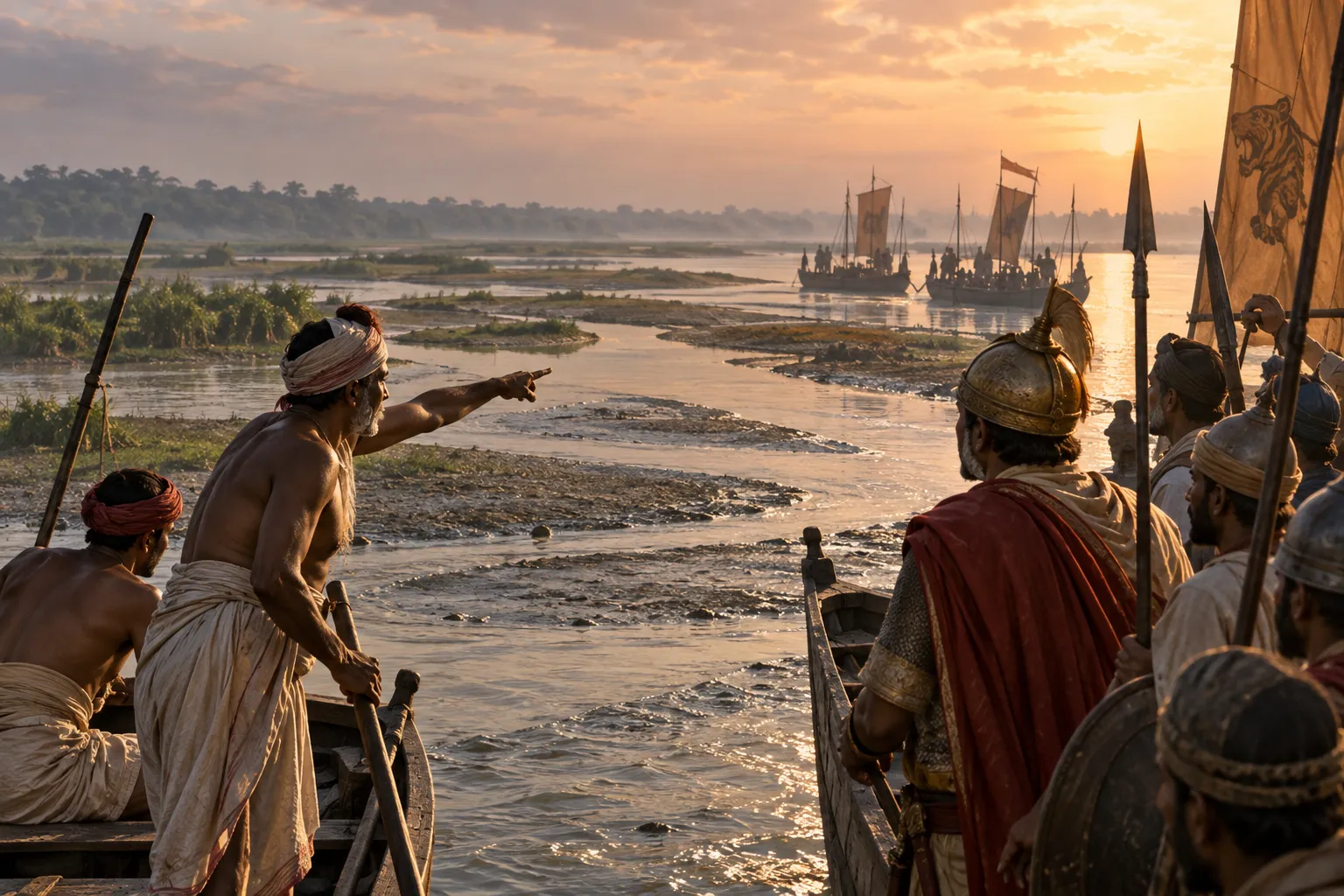
When a Fisherman’s Knowledge Became Military Power
A river can be learned in a way that a map cannot capture.
For someone who makes a living on the water, a river is not simply a line connecting two places. Its channels shift, sandbanks appear and disappear, currents behave differently from one season to another, and tides can transform a stretch of water within hours. In Bengal, where rivers formed the main connective tissue of the landscape, this practical knowledge could become a military resource.
The fisherman did not have to become a soldier for that to happen. Knowing the water could itself have military value.
The knowledge an outsider could not easily acquire
Bengal’s waterways were used every day by fishermen, boatmen, ferrymen, traders and transport workers. Their livelihoods required an intimate familiarity with local conditions: which channels were navigable, where boats could approach a bank, where the water became shallow, and how seasonal or tidal changes affected movement.
Knowledge of navigable channels was a distinctly local advantage in Bengal’s shifting delta. A force arriving from outside might understand the broad geography of the region, but that did not necessarily tell its commanders how a particular stretch of water could actually be crossed or navigated.
That difference could matter enormously in war.
A map could show a river. A river worker could show you how to use it.
When navigation became reconnaissance
The first military use of this knowledge did not have to involve combat.
An army moving through a riverine landscape needed information before it could move effectively. Which channel offered a workable route? Where could boats land? Which crossing could take men and supplies? Which stretches became dangerous at particular water levels?
River reconnaissance was therefore part of the military possibilities of Bengal’s waterways. Familiarity with local channels could help defenders identify approaching forces and select positions where the geography favoured them.
This is an important distinction. The military value of a fisherman was not necessarily that he could fight from a boat. It was that he could interpret the battlefield before the fighting began.
The tide was part of the timetable
In tidal parts of Bengal, knowing the river also meant knowing when to move.
Changing water levels affected the movement of vessels. At low tide, shallow water and exposed mud could restrict larger boats, while a rising tide could alter the possibilities for navigation.
The tide itself was neutral. It helped neither side deliberately.
But a local crew could know what was coming.
A commander unfamiliar with the environment might see an open waterway and assume that movement was possible. Someone who worked there every day could understand that the same route might be usable only at a particular stage of the tide.
In that sense, environmental knowledge became timing intelligence.
The Kaivartas were one example
The Kaivartas provide a particularly revealing example of how a river-dependent community could acquire importance in Bengal’s political and military world.
Traditionally associated with fishing and boat work, the Kaivartas lived within the same water-dependent society that supplied much of Bengal’s everyday movement and transport. Their later political rise in Varendra shows that communities associated with riverine livelihoods could become far more consequential than the simple label “fishermen” might suggest.
But the larger point does not depend on the Kaivartas alone.
The military value of river knowledge existed wherever people spent their lives working on the waterways. The person who knew a channel, a crossing or a landing place possessed information that could be useful to armies, whether that person ever carried a weapon or not.
A river could become an information network
This gave Bengal’s waterways another military function beyond transportation.
Rivers connected settlements, ports and communities. People moving along them could carry goods, messages and information. Boatmen and other river workers were therefore embedded in networks of movement that extended well beyond the individual boat.
Bengal’s naval warfare was closely connected with the movement of troops and supplies between waterways and land positions. A boat could carry soldiers. A local navigator could guide it. Someone familiar with the bank could identify a suitable landing place. Together, these skills allowed an army to operate across a landscape where roads alone could not provide the necessary mobility.
The important military asset was therefore not simply the boat.
It was the human knowledge that made the boat useful.
The stranger’s disadvantage
This helps explain why Bengal could be difficult terrain for an outside force even when that force possessed considerable military strength.
The problem was not simply the number of rivers. It was the fact that Bengal’s river landscape was dynamic.
A channel could change. A familiar crossing could become unusable. Mud could slow movement. A vessel suitable for one stretch might struggle in another. Tidal conditions could alter the depth and character of coastal waterways.
For people who lived with these changes, they were part of ordinary experience. For an army encountering them during a campaign, they could become unexpected obstacles.
This created a form of asymmetry that did not depend upon superior weapons.
One side knew the landscape through experience; the other had to learn it while fighting through it.
Knowledge could be mobilised
The existence of this expertise did not automatically make Bengal militarily invulnerable. Local knowledge was not a magical defence, and a skilled navigator could not by himself defeat an army.
Its value appeared when the state or a military commander could mobilise that knowledge.
Naval and land forces could operate together, requiring coordination between vessels, troops, transport and movement across waterways. That kind of warfare depended upon people who could make sense of the environment in practical terms.
A commander might decide where an operation should take place. A local river worker could know how to get there.
The distinction sounds small. In a delta, it was not.
An expertise built through ordinary life
There is something particularly revealing about this form of military power.
It did not necessarily originate in a military institution.
The knowledge was accumulated through fishing, boating, transport and everyday movement. Generations of people learned their waterways because their livelihoods required it. When political circumstances demanded military action, some of that knowledge could be redirected towards reconnaissance, transport and tactical movement.
This is why the history of Bengal’s navy cannot be understood only through kings, commanders and ships.
Some of its most useful expertise existed outside the formal military system.
The fisherman did not need to become a soldier
That is perhaps the most important distinction.
The military value of river knowledge did not require Bengal to turn every fisherman into a warrior. Nor does the surviving evidence justify imagining a permanently organised class of naval fighters drawn from every river-dependent community.
What mattered was simpler and more powerful.
A society that lived intimately with its waterways possessed a reservoir of environmental knowledge. In times of conflict, that knowledge could be recruited, shared or imposed into military service.
The fisherman knew where the river went.
The soldier needed to know how to follow it.
And when those two kinds of knowledge met, an ordinary skill could become a strategic advantage.
Bengal’s rivers were difficult to master from outside. But for the people who lived by them, the landscape was not an obstacle waiting to be conquered. It was a working environment whose rhythms, channels and dangers had been learned over generations.
That knowledge could move an army, guide a vessel, reveal a crossing or warn of a changing tide.
Sometimes, military power begins not with a weapon, but with knowing where the water will let you go.